 |
 |
 |
"ASBYRGI" CANYON
is a part of the
Jokulsargljufur National Park and there is the Visitor Center "Gljufrastofa ".
The Visitor Center is open from 1st of May to September 30th. Asbyrgi can
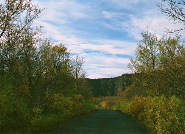
certainly be counted as one of nature’s wonders. This wonder of
nature is 3½ km long canyon with up to 100 m high walls occupied
by fulmars during the breeding season. Asbyrgi is the
northernmost section of the National Park Jokulsargljufurcanyon.
Asbyrgi lies in the north of Iceland.The distance from the
capital is about 545 km and 65 km from Husavik, the whale watching
capital of Europe. During the summer a road lies almost all the way to
its bottom, where
it is nice to walk about and enjoy the surroundings. The enormous,
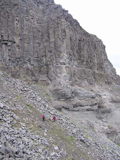
horseshoe-shaped depression measures
approximately 3.5 km in length and 1.1 km across. For more than half of
its length, the canyon is divided through the middle by a distinctive
rock formation 25 meters high called Eyjan ("the Island"), from which
hikers may enjoy spectacular views. The
canyon's steep sides are formed by cliffs up to 100 meters in
height. Down in the canyon, visitors walk through a woodland of birch
and willow. Between 1947 and 1977, a number of foreign tree species
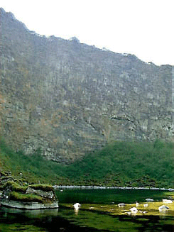
were introduced, including fir, larch and pine. A small lake called
Botnstjorn is home to a variety of waterfowl species. The well
vegetated area between the canyon walls is a very popular recreational
area, especially among families, and local festivals are celebrated
there. Here in Asbyrgi is the Information Center for the
National Park. To the Park we must take Road F862 on the west bank of
the river, which gives access to all the attractions. The
easterly road (F862)
is longer, just as rough, and is used by buses, and only gives access
to Forvod and Dettifoss. But there are no views at all from the F862
itself; you have to take the rough, hilly detours to Hljodaklettar, Vesturdalur, Holmatungur and Dettifoss to see the sights
|
|
GEOLOGY
|
Asbyrgi was most likely formed by
catastrophic glacial flooding of the river "Jokulsa a
Fjollum" from Vatnajokull glacier far in the south, the first
one about 8-10 thousand and the second about 3000 years ago .after the
last Ice Age. The river has since changed its course and now runs about
20 km to the east.
|
|
GOLF COURSE
|
The
Asbyrgi Golf Course is situated on the eastern side of the
camping site. It has 9 holes, par 33. It is a unique and pleasant
experience to hear the sound of the drive echo off the cliff walls of
Asbyrgi. It is now planned to move the course up to the cliff
tops of Asbyrgi, to Asland where it will be surrounded by
birch woods and will have an impressive view over the National Park.
|
| LEGEND |
The legend explains the unusual shape of the
canyon according to old Viking mythology. Odin, the chief
pagan god, rode his eight legged horse around the world and on that
journey the horse put down one of its legs and created a hoof like
expression in the landscape, Asbyrgi. Legend also relates
that the canyon is the capital city of the "hidden people"
(huldufolk), who live in cracks within the surrounding cliffs
|
 |
 |